Introduction
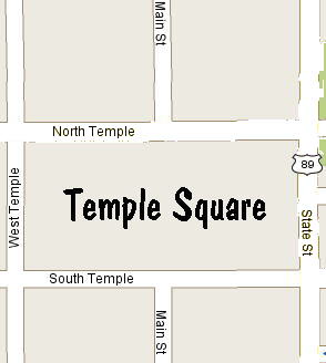
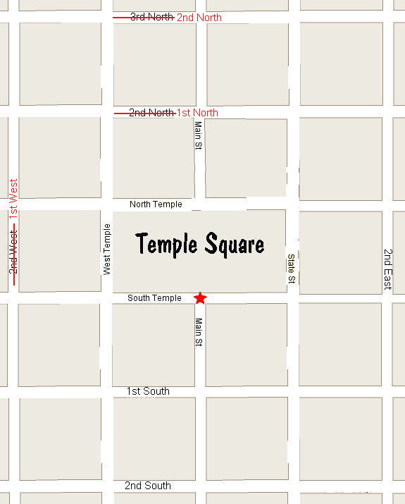
Salt Lake City follows a very logical layout, which can be daunting to anyone not from Utah. Here's an explanation of the layout. At the center of Salt Lake City is the Mormon Temple. A map of Temple Square with its surrounding streets is shown below.
Note that Temple Square is bounded on the north and south by the streets
North Temple and South Temple, and on the west by West Temple. But
the street on the eastern boundary is not named East Temple --it is State
Street. Temple Square is two blocks wide, and the north-south street
that would bisects the square if it continued through it is Main Street.
(Prior to 1999, Main Street ran right through Temple Square and it was
considered to be East Temple.)
The Grid
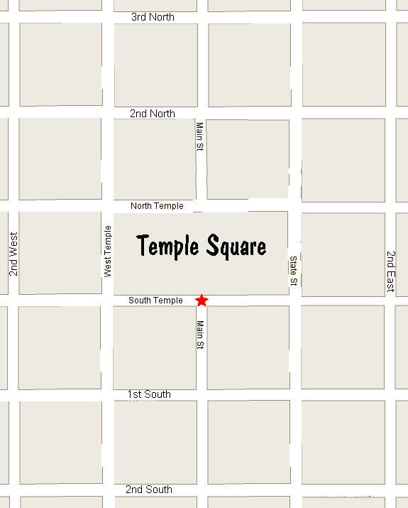
The logical center of the city is at the intersection of South Temple and Main Street. The streets south of this origin are referred to by their ordinal position from the origin, namely 1st South, 2nd South, 3rd South, etc. This is true for the other three directions as well, except that one block west, north, and east of the origin are West Temple, North Temple, and State Street respectively instead of 1st West, 1st North, and 1st East. So an idealized map of central Salt Lake City looks something like this:
The names shown above for the numbered streets are the way people in
Utah (Utahns) refer to it. Some mapmakers and signmakers refer to
streets by their block number. So 1st South becomes 100 South, 2nd
South becomes 200 South, etc. And sometimes both notations are used
in the same context. For example, exit 113 off of I-80 is labeled
"5400 West" for eastbound traffic and "54th West" for westbound traffic.
Some actual street signs list both on the same sign. There's no confusion
as to which naming convention is used because one contains an ordinal suffix
(e.g., st, nd, rd, th), whereas the other does not.
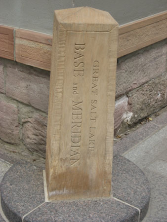
The Marker at the Center
At the logical center of the city, South Temple and Main Street, is the following marker.
House Numbering
Houses are numbered by their distance from the origin (with each of the idealized blocks above having a distance of 100 units) followed by the compass direction from the origin. So a house in the middle of the block on 500 West between 100 South and 200 South might be numbered 150 South, and the full address of that house would be 150 South 500 West. And you can interpret that address as being 150 units south and 500 units west of the origin, which is what makes Salt Lake City so logical.
Just to be confusing, some mapmakers consider the house at 150 South
500 West to be house number 150 on the street named South 500 West.
And they write South 500 West on their maps. But this is not the
way Utahns think of it -- they consider 150 South to be the house number
and 500 West (or 5th West) to be the street name. Your life will
be much simpler if you think of it the way the Utahns do.
The North East
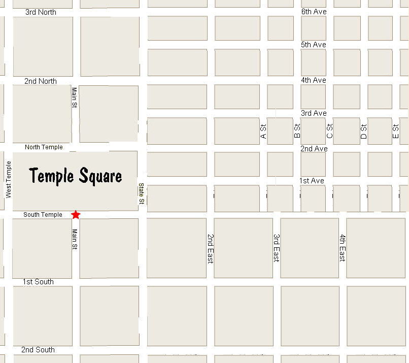
The north-east section of Salt Lake does not follow the street-naming convention of the grid described above. Instead it has numbered avenues running east-west, and lettered streets running north-south. And the distances between these streets in the north-east is half the distance between the streets in the grid.
The numbered avenues in the north-east line up with the grid streets as follows: 2nd Ave lines up with North Temple (1st North), 4th Ave lines up with 2nd North, 6th Ave lines up with 3rd North, etc. The lettered streets in the north-east are skewed with respect to the grid streets, so B St and C St are in between 3rd East and 4th East, D St and E St are in between 4th East and 5th East, etc. This is shown in the idealized map below.
The Good Old Days
Before 1973, the West and North numbered streets were numbered 100 less than what they are today. So what is today 5400 West was 5300 West before 1973. Similarly what is today 3rd North was 2nd North before 1973. The South and East numbered streets were not renumbered. And the house numbers were not changed. This makes it challenging to correlate addresses in the census with addresses of today.
What was worse, half the house addresses were not on the blocks where you would expect to find them. This drove the postal workers crazy, and was the reason for the change. To illustrate this point, consider the house that is today at 750 North 500 West. That house is on 5th West and is between 7th North and 8th North. Prior to 1973, that house had address 750 North 400 West and was between 6th North and 7th North. But at the same time, 750 South 400 West was between 7th South and 8th South, where it belonged.
Below is an idealized map of Salt Lake City prior to 1973.
Here are the points that you need to be aware of when trying to find
residences in historical documents (the census for example). If you
are looking for the residence and you have the old address, you should
have no trouble finding it. But if you are using the current address
and the residence is on a street ending in North or West, you will need
to adjust the numbered street name by 100. Do not make this
adjustment for any streets ending in East or South, or for any avenues.